
Ramshaw Rocks - Peak District Walk
Friday 31st August 2018
Having finally worked out how to get to the access point for Gradbach Hill I planned a route that would enable me to visit both this top and Ramshaw Rocks whilst returning over the Roaches. As it turned out I wasn't going to do quite the route I planned as the path over the Roaches was still shut after a recent moorland fire, so I had to return along the lane below the Roaches instead. A good excuse for a return visit.
Start: Gradbach car park (SJ 9984 6622)
Route: Gradbach car park - Gradbach Hill - Goldsitch Moss - Ramshaw Rocks - Naychurch - Hen Cloud - The Roaches - Forest Wood - Gradbach car park
Distance: 9 miles Ascent: 507 metres Time Taken: 5 hrs 45 mins
Terrain: Clear paths and some road walking.
Weather: Warm and sunny.
Pub Visited: None Ale Drunk: None
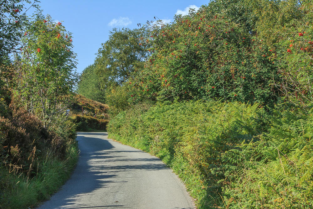
From the car park I head along the lane towards the former Gradbach Mill, which is no longer a youth hostel but a hotel catering for weddings and large groups.

Today I continue passed the entrance to the former youth hostel and continue towards the Scout Camp. Looking back I can see Cut-thorn Hill and Turn Edge on the horizon.
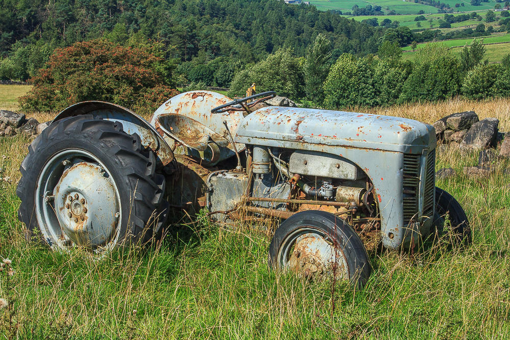
The route follows a bridleway through a farm with numerous abandoned vehicles, one of which is this tractor in the field that is the access point to Gradbach Hill.

Gaining the ridge of Gradbach Hill I can hear voices across the valley and my eye is drawn to where the people were standing on Hanging Stone.

In the opposite direction the view looks towards Three Shire Heads.

Midgley Hill from Gradbach Hill.

An abandoned building on the other side of Gradbach Hill.

Looking towards Ramshaw Rocks from Gradbach Hill, it seems I have a fair bit of walking to do.

One last look backwards before I head along the ridge path and Shutlingsloe has come into view.

As I walk along the ridge path Croker Hill comes into view.

The ridge path leads me onto a clear track to the road with the view ahead including Gib Tor and Gib Torr Rocks.

From here I head along the road but pass on visiting Gib Torr Rocks.

The road is very quiet so I don't mind using it, an alternative route is to take the footpath off Gradbach Hill that cuts across Goldsitch Moss.

Although not named on the map these rocks are known as Newstone Rocks.

I pass on visiting the rocks and instead take the path opposite, heading across the moor. Shutlingsloe and Danebower come into view as I look back after negotiating a gate that is falling apart.

The path leads me across the moor to the end of Ramshaw Rocks. For the first time on the walk I am about to meet other people.

I have driven below the rocks numerous times but this is my first visit to them.

Axe Edge in the distance, from Ramshaw Rocks.

From here I can also look across towards the Roaches.

The view south is somewhat hazy.

It would be possible to spend quite a bit of time exploring these rocks but today I pick my way through the various paths promising myself I will return on a route that will give more time here.

A final look back before I head down to the road and try to find the route to Hen Cloud, hopefully avoiding the fields with cows in them.

The view of Hen Cloud from the very well signed track around Naychurch.

The route around the back of Hen Cloud was well signed and I soon found myself heading up Hen Cloud looking across to the southern end of the Roaches.

From here it is difficult to tell if the Roaches are open or closed, although I haven't seen anyone heading up the paths onto the ridge.

I have my lunch sat on the summit of Hen Cloud looking across to Ramshaw Rocks.

As I make my way back l down I still can't see anyone on the Roaches.

Looking back towards Hen Cloud as I head down to the road, all the gates between Hen Cloud and the Roaches had signs warning that the path along the Roaches was still shut.

Looking towards Tittesworth Reservoir as I make my way along the lane below the Roaches.

Not a view I expected to see today, Five Clouds from the road.

A hazy view of Gun as I walk along the lane.

The view also includes Croker Hill.

Roach End signals the end of this unplanned section of road walking.

Looking across the Dane Valley towards Gradbach Hill as I start the descent into Forest Wood.

The final long distance view of the day looks across Birchenough Hill. All that remains is to make my way down through the wood and then the short pull back uphill to the car.
All pictures copyright © Peak Walker 2006-2023